February 12
Area:
Cardiff
Elevations, slope angles and aspects:
7500’-10700’, angles to 35°+, all aspects but west.
Avalanche activity:
East northeast facing upper Cardiac. Three slides running at different times during the storm
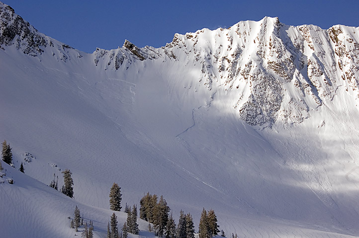
The largest and deepest was towards the Cardiac ridge run taking out the Lightning bolt apron. About 200’ wide. Up to 2’ deep That one ran over the bench into the flats about 1800’ The second, just to the south ran earlier in the storm having a coupla inches of snow over the bed surface,150’ wide. The third was on the west side of Cardiac bowl and under Cardiac pass. 150’ wide
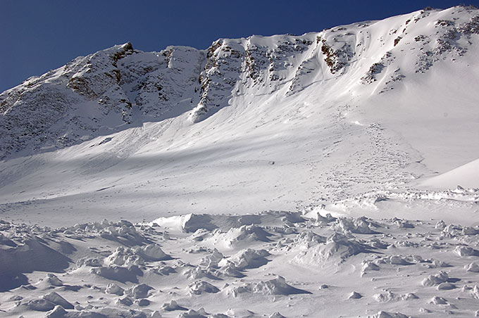
That one ran early in the storm, with a blown in crown.

Crown weak layer, Cardiac bowl

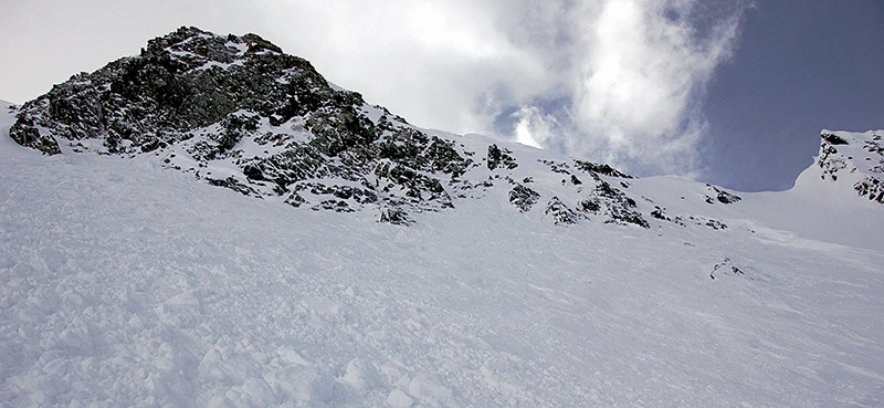
Another slide was triggered when the hang fire released above the early crown. It released from up in the rocks when I had walked about 10’ beyond the bed surface onto un avalanched snow, catching my partner and carrying her down hill, perhaps 40’. No burial as there wasn’t a lot of snow remaining to slide. It did pull out deeper under Cardiac pass, with a crown of around 2’ in places. 100’ wide.
Slopes skied:
Both sides of Powerline ridge and Cardiac bowl, out Cardiff.
Snow surface and conditions:
There was about 14-16” new snow. The upper 4” was of a ligher density. Middle layering was dense and provided support. The lower, first storm snow was of a lighter density. South faces were dry in the morning but quickly went off and got wet. There may have been wet activity in the afternoon. North facing provided good fast skiing on both the lower angled and steeper hills. Collapsing was felt all day, with some shooting cracks and one slide triggered. The slide was described above. The layering was the 14” of new snow over damp facets, large grained. I was making snowballs with those facets while looking at the older crown. Part of the crown also had the crust facet sandwich. Slide was collapse failure, with a distinct collapse both heard and felt. I ran off the slide and watched it run behind me. Lower elevations below about 8500’ have significantly less new storm snow. That was still dry as we exitied Cardiff in the afternoon, at least in the shade.
Weather:
Bluebird with occasional gusty west winds and moderate to mild temperatures.
Evaluation:
The new snow remains sensitive. Collapses were frequent and widespread on the shady side extending onto the off aspects, especially east facing. I would expect continued hazard, particularly in upper elevation terrain with an easterly facing component and with wind loading. Mid and lower elevations would also retain a more localized hazard in the same categorization as above listed.© wowasatch.com